This is the first time since 2002 that I haven’t produced a winter outlook. Part of the reason behind this is due to the fact that our recent move back from Cleveland, OH to Indianapolis has taken priority. Moving is always a much bigger chore than you expect originally. That said, the upcoming winter of 2013-2014 presents quite the challenge when trying to determine what particular player takes control for the “long haul.” I can’t remember a time when so many variables were at play, presenting quite the headache in trying to determine which one will take the lead. Ultimately, confidence is lower than normal for the winter forecast. That said, “confidence” in something 3-4 months out is never considered high. 🙂
Here are just a few items I’m looking at for the upcoming winter:
1. Data is pointing towards a southeast ridge in play for the better part of the upcoming winter.
The strength and precise position of the ridge will go a long way in aiding our weather here in central Indiana. Southeast ridging isn’t always a bad thing in the winter if you’re a cold and snow fan as storms can’t “escape” harmlessly to our south or east. That said, should we deal with a strong southeast ridge then we’re looking at a warmer, rainier time of things here as opposed to cold and snowy…
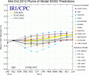
2. Modeling suggesting Nino Region 3.4 warms slightly as we progress through the winter months.
The implications here are interesting when we drill down to the “home front.” The following data from similar conditions during December-February in Nino Region 3.4 correlate to a few years that will go down in Hoosier snow lovers dreams…
Courtesy: http://www.cpc.ncep.noaa.gov/products/analysis_monitoring/ensostuff/ensoyears.shtml
- 1977-1978: 49.7″ of snow, 2nd snowiest winter on record; Nino Region 3.4: +0.8
- 2002-2003: 46.9″ of snow, 4th snowiest winter on record; Nino Region 3.4: +1.2
- 2009-2010: 32.2″ of snow, 10th snowiest winter on record; Nino Region 3.4: +1.6
3. NAO showing signs of going negative when it matters most?
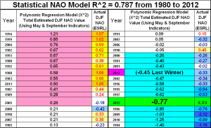
Labeled as the new “NAO Model everyone is looking for” may, perhaps, be just that. This formula has already proven to be incredibly accurate in the past. This was developed by fellow midwestern, Al Marinaro (you can follow him on Twitter at @wxmidwest). In the past I’ve been one to say it’s incredibly difficult to forecast the NAO beyond 2-3 weeks, but we look at water temperatures this time of year to try and get an idea of what may happen in the coming winter months ahead. If Mr. Marinaro is on to something (and it appears that he is) that longstanding idea will all change.
Additionally, to the delight of many cold and snow lovers out there, Mr. Marinaro’s formula suggests we’re heading for a predominantly negative NAO this winter.
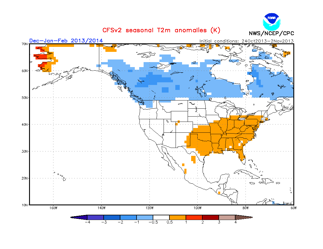
4. The normally “highly variable” CFSv2 (Climate Forecast System) monthly run has remained consistent as of late in thinking the east is warmer than normal for meteorological winter.
It’s amazing how often this model is shown when forecasting cold, but seemingly forgotten when it’s forecasting warmer than normal conditions.


